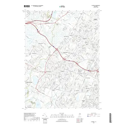
2019 Map of Caldwell
USGS Topo · Published 2019About this map
Caldwell and Livingston serve as the primary hubs in this suburban landscape of the late 2010s, where the expansion of Essex and Morris counties is visible through a dense network of residential streets and arterial roads. The Passaic River meanders through the western portion, bordering significant wetlands like Hatfield Swamp and Great Piece Meadows. These natural features provide a sharp contrast to the developed corridors along Eisenhower Pkwy and S Orange Ave.
Find a feature on this map
75 named features on this map. Tap any name to fly to it.
Don’t see what you’re looking for? This feature index may not catch every label — zoom into the map to look around manually.
Map Details
Editions of this 2019 Caldwell Map
This is the sole edition of this map. No revisions or reprints were ever made.
Other maps of this area

1888 · Plainfield
USGS Topo · 1:62,500

1888 · Morristown
USGS Topo · 1:62,500

1888 · Paterson
USGS Topo · 1:62,500

1892 · Paterson
USGS Topo · 1:62,500

1893 · Plainfield
USGS Topo · 1:62,500

1894 · Morristown
USGS Topo · 1:62,500

1898 · Morristown
USGS Topo · 1:62,500

1898 · Plainfield
USGS Topo · 1:62,500

1898 · Staten Island
USGS Topo · 1:62,500

1898 · Paterson
USGS Topo · 1:62,500