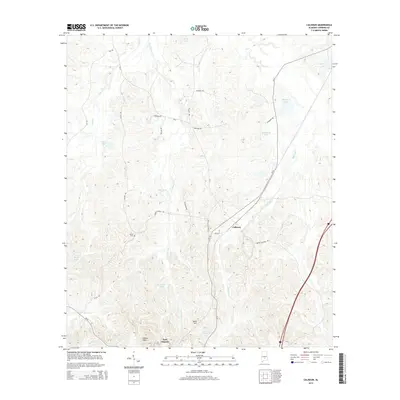
2014 Map of Calhoun
USGS Topo · Published 2014About this map
Fort Deposit anchors the southern landscape of this Lowndes County terrain, situated where the rolling elevations of the Gilmer Hills begin to level. The settlement of Calhoun serves as a secondary focal point, connected to the surrounding countryside by a network of local routes including Calhoun Cut-Off Rd and Bishop Bottom Rd. The area is defined by its complex drainage systems, with Fort Deposit Cr and Ballards Cr carving through the topography. Numerous small water bodies such as Collins Lake, Hammonds Lake, and Lanes Pond suggest a landscape shaped by both natural drainage and local land use. Genealogists may find value in the location of Salem Cem, a quiet landmark situated west of the main Calhoun settlement near Church Rd. This survey provides a clear view of the rural infrastructure of the early 21st century, from the primary corridor of CR-37 to the smaller tracks of Lum Rd and Dickey Rd.
Find a feature on this map
36 named features on this map. Tap any name to fly to it.
Don’t see what you’re looking for? This feature index may not catch every label — zoom into the map to look around manually.
Map Details
Editions of this 2014 Calhoun Map
This is the sole edition of this map. No revisions or reprints were ever made.
Other maps of this area

1953 · Montgomery
USGS Topo · 1:250,000

1953 · Andalusia
USGS Topo · 1:250,000

1956 · Montgomery
USGS Topo · 1:250,000

1957 · Montgomery
USGS Topo · 1:250,000

1957 · Andalusia
USGS Topo · 1:250,000

1957 · Letohatchee
USGS Topo · 1:62,500

1971 · Fort Deposit
USGS Topo · 1:24,000

1971 · Fort Dale
USGS Topo · 1:24,000

1971 · Danielsville
USGS Topo · 1:24,000
1981 · Calhoun
USGS Topo · 1:24,000