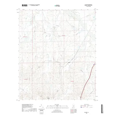
2018 Map of Calhoun
USGS Topo · Published 2018About this map
Fort Deposit anchors the southern portion of this Lowndes County landscape, where the terrain shifts from the elevations of the Gilmer Hills toward the lower drainage basins of Beaver Cr and Mussel Cr. The area is defined by a dense network of local roads and water bodies, including Lanes Pond, Hartleys Pond, and several named lakes such as Collins Lake and Midfield Lake. The settlement of Calhoun sits centrally, positioned near the junction of several routes including Julian Town Rd and the Calhoun Cutoff. Local history is anchored by the Salem Cem located near Salem Church Rd, providing a specific point of interest for genealogical research. The varied topography, featuring landmarks like Skidl Hill and the Ridgefield area, reflects the agricultural and rural character of the Alabama Black Belt region.
Find a feature on this map
44 named features on this map. Tap any name to fly to it.
Don’t see what you’re looking for? This feature index may not catch every label — zoom into the map to look around manually.
Map Details
Editions of this 2018 Calhoun Map
This is the sole edition of this map. No revisions or reprints were ever made.
Other maps of this area

1953 · Montgomery
USGS Topo · 1:250,000

1953 · Andalusia
USGS Topo · 1:250,000

1956 · Montgomery
USGS Topo · 1:250,000

1957 · Montgomery
USGS Topo · 1:250,000

1957 · Andalusia
USGS Topo · 1:250,000

1957 · Letohatchee
USGS Topo · 1:62,500

1971 · Fort Deposit
USGS Topo · 1:24,000

1971 · Fort Dale
USGS Topo · 1:24,000

1971 · Danielsville
USGS Topo · 1:24,000
1981 · Calhoun
USGS Topo · 1:24,000