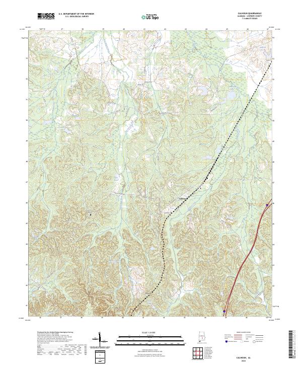
2024 Map of Calhoun
USGS Topo · Published 2024About this map
Calhoun serves as the central hub of this Lowndes County landscape, where the rural topography is defined by an intricate network of waterways and modest elevations. The Gilmer Hills and Skid Hill rise above the drainage basins of Fort Deposit Creek and Ballards Creek, illustrating the characteristic drainage patterns of this portion of Alabama. Local history is anchored by sites like the Salem Cem, which marks an established point of community lineage near the western edge of the map. Numerous small water bodies, including Lanes Pond, Hartleys Pond, and Hammond Lake, indicate a region heavily utilized for agriculture or private land management. The road network, comprising routes like Julian Town Rd and Salem Church Rd, reflects a long-standing settlement pattern where family names and local landmarks like Collins Lake dictated the movement of residents through the hills.
Find a feature on this map
42 named features on this map. Tap any name to fly to it.
Don’t see what you’re looking for? This feature index may not catch every label — zoom into the map to look around manually.
Map Details
Editions of this 2024 Calhoun Map
This is the sole edition of this map. No revisions or reprints were ever made.
Other maps of this area

1953 · Montgomery
USGS Topo · 1:250,000

1953 · Andalusia
USGS Topo · 1:250,000

1956 · Montgomery
USGS Topo · 1:250,000

1957 · Montgomery
USGS Topo · 1:250,000

1957 · Andalusia
USGS Topo · 1:250,000

1957 · Letohatchee
USGS Topo · 1:62,500

1971 · Fort Deposit
USGS Topo · 1:24,000

1971 · Fort Dale
USGS Topo · 1:24,000

1971 · Danielsville
USGS Topo · 1:24,000
1981 · Calhoun
USGS Topo · 1:24,000