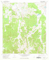
1981 Map of Calhoun
USGS Topo · Published 1981About this map
Calhoun and New Hope anchor this Lowndes County landscape during the early 1980s, positioned along the vital transportation corridor of the Louisville and Nashville railroad. The terrain is defined by a dense network of watercourses, including Big Swamp Creek, Fort Deposit Creek, and Ballards Creek, which carve through the rural acreage. Local community life is evidenced by numerous country churches such as Big Union Ch, Mt Calvary Ch, and Temple Gate Ch, which serve as important landmarks for genealogical research in this part of Alabama. The map also delineates the northern limits of the Fort Deposit Corp Bdy, showing how the town's influence extends into the surrounding agricultural and swampy lands. Man-made water features like Midfield Lake and Hammond Lake dot the northern sections, suggesting a landscape modified for local utility and recreation amidst the natural drainage of the region.
Find a feature on this map
19 named features on this map. Tap any name to fly to it.
Don’t see what you’re looking for? This feature index may not catch every label — zoom into the map to look around manually.
Map Details
Editions of this 1981 Calhoun Map
This is the sole edition of this map. No revisions or reprints were ever made.
Other maps of this area

1953 · Montgomery
USGS Topo · 1:250,000

1953 · Andalusia
USGS Topo · 1:250,000

1956 · Montgomery
USGS Topo · 1:250,000

1957 · Montgomery
USGS Topo · 1:250,000

1957 · Andalusia
USGS Topo · 1:250,000

1957 · Letohatchee
USGS Topo · 1:62,500

1971 · Fort Deposit
USGS Topo · 1:24,000

1971 · Fort Dale
USGS Topo · 1:24,000

1971 · Danielsville
USGS Topo · 1:24,000
1981 · Letohatchee
USGS Topo · 1:24,000