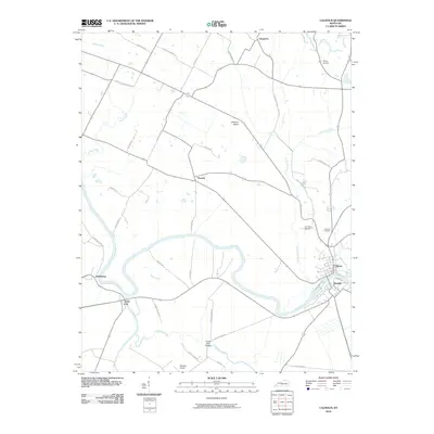
2010 Map of Calhoun
USGS Topo · Published 2010About this map
The Green River meanders through the heart of McLean County, defining the landscape and historic settlement patterns of Calhoun and its southern neighbor Rumsey. This 2010 survey illustrates a region where water remains the central geographic feature, as the Green River is joined by significant tributaries including Eagle Creek, Pond River, and Cypress Creek. The river's winding path creates distinct landforms such as Johnson Island and influences the placement of riverfront communities like Ashbyburg.
Find a feature on this map
43 named features on this map. Tap any name to fly to it.
Don’t see what you’re looking for? This feature index may not catch every label — zoom into the map to look around manually.
Map Details
Editions of this 2010 Calhoun Map
This is the sole edition of this map. No revisions or reprints were ever made.
Other maps of this area

1906 · Sutherland
USGS Topo · 1:62,500

1908 · Calhoun
USGS Topo · 1:62,500

1909 · Madisonville
USGS Topo · 1:62,500

1909 · Central City
USGS Topo · 1:62,500

1952 · Livermore
USGS Topo · 1:24,000

1952 · Sacramento
USGS Topo · 1:24,000

1952 · Calhoun
USGS Topo · 1:24,000

1952 · Beech Grove
USGS Topo · 1:24,000

1952 · Hanson
USGS Topo · 1:24,000
1953 · Glenville
USGS Topo · 1:24,000