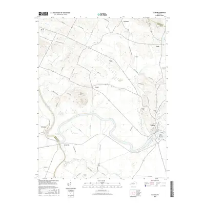
2016 Map of Calhoun
USGS Topo · Published 2016About this map
The Green River carves a winding path through this western Kentucky landscape, separating the communities of Calhoun and Rumsey at the eastern edge of the quadrangle. This 2016 survey documents the rural character of McLean County, where agricultural fields and small settlements like Beech Grove, Poverty, and Jewel City are linked by a network of named country roads and historical ferries. The terrain is marked by significant features like The Bend and Tichenor Hills, which rise above the river valley.
Find a feature on this map
62 named features on this map. Tap any name to fly to it.
Don’t see what you’re looking for? This feature index may not catch every label — zoom into the map to look around manually.
Map Details
Editions of this 2016 Calhoun Map
This is the sole edition of this map. No revisions or reprints were ever made.
Other maps of this area

1906 · Sutherland
USGS Topo · 1:62,500

1908 · Calhoun
USGS Topo · 1:62,500

1909 · Madisonville
USGS Topo · 1:62,500

1909 · Central City
USGS Topo · 1:62,500

1952 · Livermore
USGS Topo · 1:24,000

1952 · Sacramento
USGS Topo · 1:24,000

1952 · Calhoun
USGS Topo · 1:24,000

1952 · Beech Grove
USGS Topo · 1:24,000

1952 · Hanson
USGS Topo · 1:24,000
1953 · Glenville
USGS Topo · 1:24,000