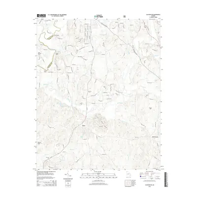
2014 Map of Calhoun NE
USGS Topo · Published 2014About this map
The Conasauga River winds along the border between Whitfield and Murray Counties, defining a landscape of creek-fed bottomlands and rising ridges. Small settlements like Holley and Ball Ground are connected by a network of rural routes, including the prominent Ga-225 corridor. For family historians, the sheet is heavily dotted with family-named burial grounds, including the Kilgore Cem, Osborn Cem, and Williams Cem, often located near prominent terrain features like Fincher Bluff or the banks of Holly Creek. The western edge of the quadrangle shows the infrastructure of the Dalton Municipal Airport, contrasting with the more pastoral eastern reaches that approach the C N F boundary. Numerous minor waterways such as Casey Springs Br and Polecat Cr illustrate the complex drainage system feeding into the larger river valleys.
Find a feature on this map
130 named features on this map. Tap any name to fly to it.
Don’t see what you’re looking for? This feature index may not catch every label — zoom into the map to look around manually.
Map Details
Editions of this 2014 Calhoun NE Map
This is the sole edition of this map. No revisions or reprints were ever made.
Other maps of this area

1886 · Dalton
USGS Topo · 1:125,000

1892 · Dalton
USGS Topo · 1:125,000

1897 · Dalton
USGS Topo · 1:125,000

1911 · Cohutta Mtn
USGS Topo · 1:62,500

1913 · Cohutta Mtn.
USGS Topo · 1:62,500

1914 · Talking Rock
USGS Topo · 1:62,500

1916 · Talking Rock
USGS Topo · 1:62,500

1938 · Chatsworth
USGS Topo · 1:48,000

1943 · Dalton
USGS Topo · 1:62,500
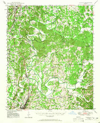
1949 · Calhoun
USGS Topo · 1:62,500