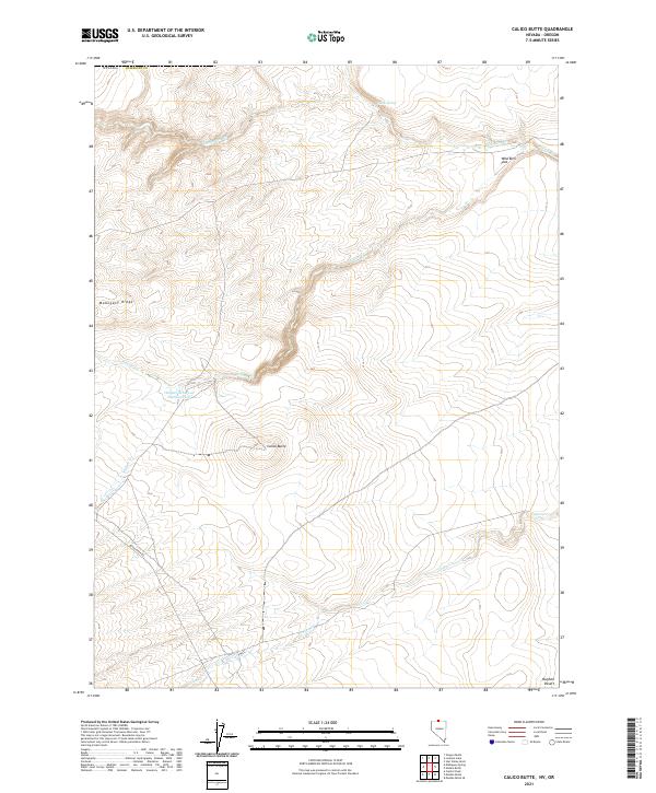
2021 Map of Calico Butte
USGS Topo · Published 2021About this map
Calico Butte stands as a central geographic marker in this section of the Nevada high desert near the Oregon border. The landscape is defined by its seasonal drainage systems and remote topographic features, such as Mahogany Ridge and the broad expanse of Wild Bills Flat. Water management in this arid environment is evidenced by the Owyhee Reservoir Number Four, while smaller sources like Willow Spring provide critical points of interest for historical tracking. The area is accessed via the Quinn River Rd, which threads through the complex system of drainages including Calico Cr, Mahogany Cr, and Willow Cr. This 2021 survey by the U.S. Geological Survey details the contemporary state of these landforms and water catchments within Humboldt County.
Find a feature on this map
16 named features on this map. Tap any name to fly to it.
Don’t see what you’re looking for? This feature index may not catch every label — zoom into the map to look around manually.
Map Details
Editions of this 2021 Calico Butte Map
This is the sole edition of this map. No revisions or reprints were ever made.
Other maps of this area

1882 · Paradise
USGS Topo · 1:250,000

1893 · Paradise
USGS Topo · 1:250,000

1955 · McDermitt
USGS Topo · 1:250,000

1955 · Jordan Valley
USGS Topo · 1:250,000

1957 · Jordan Valley
USGS Topo · 1:250,000

1958 · Jordan Valley
USGS Topo · 1:250,000

1959 · McDermitt
USGS Topo · 1:250,000

1980 · Calico Butte
USGS Topo · 1:24,000

1980 · Capitol Peak
USGS Topo · 1:24,000

1980 · Mahogany Spring
USGS Topo · 1:24,000