
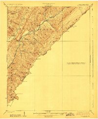
1923 Map of Callaghan
USGS Topo · Published 1923About this map
Columbia Sulphur Springs anchors the northern reaches of this 1921 survey, situated along the complex drainage of Anthony Creek and W and H Creek. This transition zone between West Virginia and Virginia is defined by a dense network of schoolhouses, suggesting a highly decentralized but active rural population in the early twentieth century. These one-room educational landmarks, such as Slabcamp School, Bound School, and Hull School, are found tucked into nearly every hollow and draft, serving the scattered homes of the Little Allegheny Ridge.
Find a feature on this map
54 named features on this map. Tap any name to fly to it.
Don’t see what you’re looking for? This feature index may not catch every label — zoom into the map to look around manually.
Map Details
Editions of this 1923 Callaghan Map
3 editions found
Other maps of this area

1887 · Lewisburg
USGS Topo · 1:125,000

1891 · Lewisburg
USGS Topo · 1:125,000

1891 · Huntersville
USGS Topo · 1:125,000

1894 · Huntersville
USGS Topo · 1:125,000

1894 · Natural Bridge
USGS Topo · 1:125,000

1901 · Monterey
USGS Topo · 1:125,000

1913 · Eagle Rock
USGS Topo · 1:48,000

1915 · Eagle Rock
USGS Topo · 1:62,500

1921 · Callaghan
USGS Topo · 1:48,000

1921 · White Sulphur Springs
USGS Topo · 1:48,000