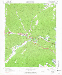
1966 Map of Callaghan
USGS Topo · Published 1967About this map
Dunlap Creek and the Chesapeake and Ohio railway corridor form the primary artery through this section of Alleghany County during the mid-1960s. The settlement at Callaghan serves as a central point where Johnsons Creek and Ogle Creek converge, surrounded by the steep elevations of Oliver Mountain and Peters Mountain. This landscape within the George Washington National Forest is dotted with rural landmarks essential for genealogists, including Hoke Chapel, Fletcher Chapel, and the Helmintoller Cemetery.
Find a feature on this map
54 named features on this map. Tap any name to fly to it.
Don’t see what you’re looking for? This feature index may not catch every label — zoom into the map to look around manually.
Map Details
Editions of this 1966 Callaghan Map
2 editions found
Other maps of this area

1887 · Lewisburg
USGS Topo · 1:125,000

1891 · Lewisburg
USGS Topo · 1:125,000

1894 · Natural Bridge
USGS Topo · 1:125,000

1913 · Eagle Rock
USGS Topo · 1:48,000

1915 · Eagle Rock
USGS Topo · 1:62,500

1921 · Callaghan
USGS Topo · 1:48,000

1923 · Callaghan
USGS Topo · 1:62,500

1929 · Falling Spring
USGS Topo · 1:24,000

1932 · Falling Spring
USGS Topo · 1:31,680

1945 · Clifton Forge
USGS Topo · 1:62,500