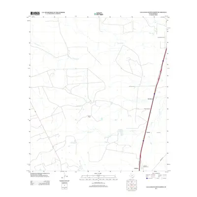
2013 Map of Callaghan Ranch North
USGS Topo · Published 2013About this map
San Ramon Ranch and the nearby settlement of San Ramon anchor this portion of the South Texas brush country in Webb County. The landscape is defined by vast ranching tracts and intermittent watercourses, most notably the winding paths of Jaboncillo Cr and Dolores Cr. Transportation infrastructure is concentrated along the eastern edge of the quadrangle, where the Frontage Rd parallels a primary highway corridor, connecting the small communities of Cactus and Callaghan.
Find a feature on this map
17 named features on this map. Tap any name to fly to it.
Don’t see what you’re looking for? This feature index may not catch every label — zoom into the map to look around manually.
Map Details
Editions of this 2013 Callaghan Ranch North Map
This is the sole edition of this map. No revisions or reprints were ever made.
Other maps of this area

1929 · Cotulla
USGS Topo · 1:125,000

1940 · Velenzuela Creek
USGS Topo · 1:62,500

1953 · Crystal City
USGS Topo · 1:250,000

1955 · Crystal City
USGS Topo · 1:250,000

1956 · Las Tiendas
USGS Topo · 1:62,500

1956 · Webb
USGS Topo · 1:62,500

1956 · Laredo
USGS Topo · 1:250,000

1957 · Encinal
USGS Topo · 1:62,500

1961 · Crystal City
USGS Topo · 1:250,000

1965 · Spohn Ranch
USGS Topo · 1:24,000