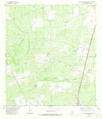
1980 Map of Callaghan Ranch North
USGS Topo · Published 1980About this map
Cerrito Prieto Ranch and San Roman Ranch anchor this landscape of the South Texas brush country as it appeared in the early 1980s. The terrain is defined by a network of drainage ways including Jabonci llo Creek, Dolores Creek, and Arroyo Blanco, which cut through the ranchlands toward the southeast. Evidence of the region's energy and infrastructure development is prominent, marked by numerous Oil Wells, a Pipeline, and a Landing Strip. The eastern edge of the survey is dominated by the industrial corridor of the Missouri Pacific railroad, which runs parallel to the highway through the small settlements of Cactus and San Roman. Cultural landmarks are sparse but specific, including a Roadside Park and a lone Cem near the rail line, providing critical points of interest for genealogists and local historians studying the rural layout of Webb County before modern expansion.
Find a feature on this map
21 named features on this map. Tap any name to fly to it.
Don’t see what you’re looking for? This feature index may not catch every label — zoom into the map to look around manually.
Map Details
Editions of this 1980 Callaghan Ranch North Map
This is the sole edition of this map. No revisions or reprints were ever made.
Other maps of this area

1929 · Cotulla
USGS Topo · 1:125,000

1940 · Velenzuela Creek
USGS Topo · 1:62,500

1953 · Crystal City
USGS Topo · 1:250,000

1955 · Crystal City
USGS Topo · 1:250,000

1956 · Las Tiendas
USGS Topo · 1:62,500

1956 · Webb
USGS Topo · 1:62,500

1956 · Laredo
USGS Topo · 1:250,000

1957 · Encinal
USGS Topo · 1:62,500

1961 · Crystal City
USGS Topo · 1:250,000

1965 · Spohn Ranch
USGS Topo · 1:24,000