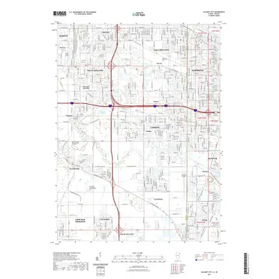
2021 Map of Calumet City
USGS Topo · Published 2021About this map
Hammond and Calumet City anchor this heavily developed industrial and residential landscape straddling the Illinois and Indiana state line. The map reveals an intricate network of surface streets and modern expressways that have redefined the region, yet traditional markers of local heritage remain prominent. Numerous cemeteries, including the expansive Oakland-Memory Lanes Cem and Assumption Catholic Cem and Mausoleum, serve as vital touchstones for genealogists tracing family roots in the South Side suburbs. Waterways like the Grand Calumet River and Thorn Creek navigate the dense grid, while specialized facilities such as the Lansing Municipal Airport and South Suburban College reflect the area's mid-century growth and infrastructure. Smaller neighborhoods like Schrum, Bernice, and Oakglen provide local context for the larger urban centers of Lansing and South Holland.
Find a feature on this map
210 named features on this map. Tap any name to fly to it.
Don’t see what you’re looking for? This feature index may not catch every label — zoom into the map to look around manually.
Map Details
Editions of this 2021 Calumet City Map
This is the sole edition of this map. No revisions or reprints were ever made.
Other maps of this area

1892 · Calumet
USGS Topo · 1:62,500

1893 · Calumet
USGS Topo · 1:62,500

1900 · Toleston
USGS Topo · 1:62,500

1900 · Calumet
USGS Topo · 1:62,500

1901 · Calumet
USGS Topo · 1:62,500

1929 · Calumet Lake
USGS Topo · 1:24,000

1929 · Calumet City
USGS Topo · 1:24,000
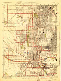
1929 · Blue Island
USGS Topo · 1:24,000

1929 · Harvey
USGS Topo · 1:24,000

1929 · Dyer
USGS Topo · 1:24,000