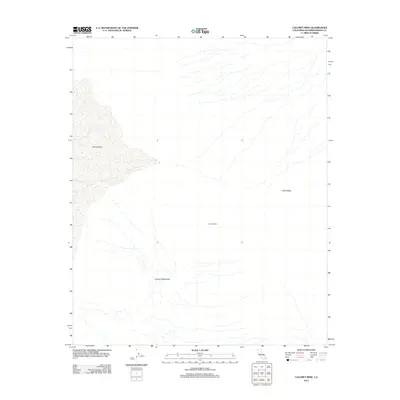
2012 Map of Calumet Mine
USGS Topo · Published 2012About this map
Calumet Mine sits at the heart of this desert landscape in San Bernardino County, centered between the dry expanse of the Cadiz Valley and the jagged peaks of the Calumet Mountains. The topography is dominated by the western shoreline of Bristol Lake, a prominent dry lake bed or playa that characterizes this arid region of the Mojave. This 2011 survey, compiled by the U.S. Geological Survey, illustrates the sparse but significant human footprint in a region defined by mineral extraction and extreme terrain. The map provides a clear record of the access roads and landforms surrounding the mine site, essential for researchers tracking industrial history or desert geography in the early twenty-first century.
Find a feature on this map
4 named features on this map. Tap any name to fly to it.
Don’t see what you’re looking for? This feature index may not catch every label — zoom into the map to look around manually.
Map Details
Editions of this 2012 Calumet Mine Map
This is the sole edition of this map. No revisions or reprints were ever made.
Other maps of this area

1942 · Amboy
USGS Topo · 1:250,000

1943 · Amboy
USGS Topo · 1:250,000

1943 · Danby
USGS Topo · 1:62,500

1943 · Cadiz Lake
USGS Topo · 1:62,500

1954 · Needles
USGS Topo · 1:250,000

1954 · Bristol Lake NW
USGS Topo · 1:24,000

1954 · Bristol Lake SW
USGS Topo · 1:24,000

1956 · Needles
USGS Topo · 1:250,000

1956 · Bristol Lake
USGS Topo · 1:62,500

1956 · Cadiz Lake
USGS Topo · 1:62,500