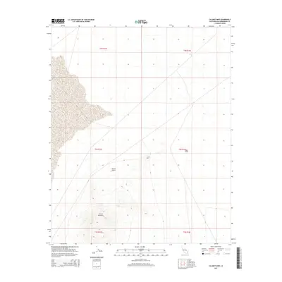
2015 Map of Calumet Mine
USGS Topo · Published 2015About this map
The Calumet Mine sits at the heart of this arid landscape, nestled between the southern reach of the Cadiz Valley and the rising peaks of the Calumet Mountains. This high-desert terrain within the Mojave Desert shows a classic pattern of remote industrial activity defined by isolation and topography. The map illustrates how mining operations are concentrated around the primary geological formations, with the surrounding valley floors remaining largely undeveloped. Public land survey system lines, including t4n r13e and t4n r14e, provide a rigid grid over the undulating contours of the desert, where dramatic elevation changes in the mountains contrast sharply with the broad, open basins of the valley.
Find a feature on this map
10 named features on this map. Tap any name to fly to it.
Don’t see what you’re looking for? This feature index may not catch every label — zoom into the map to look around manually.
Map Details
Editions of this 2015 Calumet Mine Map
This is the sole edition of this map. No revisions or reprints were ever made.
Other maps of this area

1942 · Amboy
USGS Topo · 1:250,000

1943 · Amboy
USGS Topo · 1:250,000

1943 · Danby
USGS Topo · 1:62,500

1943 · Cadiz Lake
USGS Topo · 1:62,500

1954 · Needles
USGS Topo · 1:250,000

1954 · Bristol Lake NW
USGS Topo · 1:24,000

1954 · Bristol Lake SW
USGS Topo · 1:24,000

1956 · Needles
USGS Topo · 1:250,000

1956 · Bristol Lake
USGS Topo · 1:62,500

1956 · Cadiz Lake
USGS Topo · 1:62,500