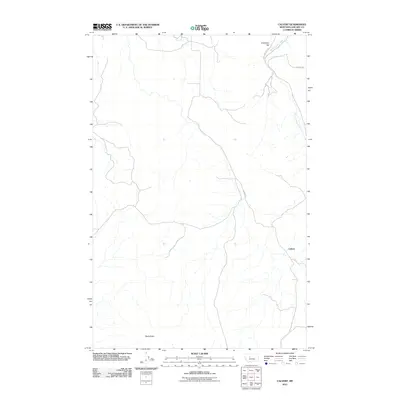
2011 Map of Calvert
USGS Topo · Published 2011About this map
Calvert sits in the heart of this central Montana landscape, where the drainage of Sand Coulee Creek winds through the hills of Cascade County. The terrain is defined by prominent high points such as Creamery Hill in the north and Black Butte near the southern boundary, indicating the varied elevation of this ranching and rural region. A network of local roads, including Evans Riceville Rd and Johnson Rd, provides access to these isolated elevations and creek bottoms. The presence of Calvert Rd connecting the settlement to the surrounding foothills illustrates the enduring transportation patterns of this upland territory during the early 21st century.
Find a feature on this map
7 named features on this map. Tap any name to fly to it.
Don’t see what you’re looking for? This feature index may not catch every label — zoom into the map to look around manually.
Map Details
Editions of this 2011 Calvert Map
This is the sole edition of this map. No revisions or reprints were ever made.
Other maps of this area

1886 · Great Falls
USGS Topo · 1:250,000

1954 · Great Falls
USGS Topo · 1:250,000

1955 · Stockett
USGS Topo · 1:62,500

1955 · Gore Hill
USGS Topo · 1:62,500

1957 · Great Falls
USGS Topo · 1:250,000

1965 · Eden
USGS Topo · 1:24,000
1965 · Stockett
USGS Topo · 1:24,000

1965 · Mahoney Hill
USGS Topo · 1:24,000
1971 · Boston Coulee School
USGS Topo · 1:24,000
1971 · Deep Creek Park
USGS Topo · 1:24,000