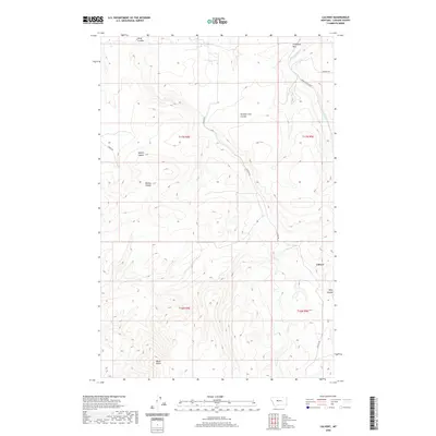
2020 Map of Calvert
USGS Topo · Published 2020About this map
Calvert sits within a landscape defined by its high plateaus and deep drainage systems, including the waters of Sand-Coulee Cr and the winding Ming Coulee. The terrain is characterized by prominent landmarks like Creamery Hill and Black Butte, which rise above the surrounding plains. The naming of local features like Number Five Coulee, Splain Coulee, and Boston Coulee suggests a history of ranching or mining activity, while the local road network, featuring Evans-Riceville Rd and Calvert Rd, provides the primary access through this section of Cascade County. This 2020 map documents the modern topographic character of the region, showing the enduring rural layout and the persistent importance of natural watercourses in shaping the location's development and transport routes.
Find a feature on this map
16 named features on this map. Tap any name to fly to it.
Don’t see what you’re looking for? This feature index may not catch every label — zoom into the map to look around manually.
Map Details
Editions of this 2020 Calvert Map
This is the sole edition of this map. No revisions or reprints were ever made.
Other maps of this area

1886 · Great Falls
USGS Topo · 1:250,000

1954 · Great Falls
USGS Topo · 1:250,000

1955 · Stockett
USGS Topo · 1:62,500

1955 · Gore Hill
USGS Topo · 1:62,500

1957 · Great Falls
USGS Topo · 1:250,000

1965 · Eden
USGS Topo · 1:24,000
1965 · Stockett
USGS Topo · 1:24,000

1965 · Mahoney Hill
USGS Topo · 1:24,000
1971 · Boston Coulee School
USGS Topo · 1:24,000
1971 · Deep Creek Park
USGS Topo · 1:24,000