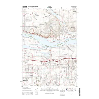
2013 Map of Camas
USGS Topo · Published 2013About this map
Camas and Washougal anchor the northern bank of the Columbia River in this 2013 survey, where industrial landscapes meet the water at Fisher Quarry Channel. The map illustrates a densely interconnected corridor between Vancouver and Portland, showing the expansion of the Portland Light Rail System into Gresham and Rockwood. To the south, the terrain transitions into the Mount Hood National Forest near Broughton Bluff, while the Sandy River and Fairview Lake define the eastern lowlands. Genealogists will find several burial grounds noted, including Fern Prairie Cem and Knight Cem. The geography of the river itself is a primary focus, featuring numerous islands such as Ackerman Island and Sand Island alongside aviation and recreational hubs like the Portland-Troutdale Airport and Edgefield Red Shed Amphitheater.
Find a feature on this map
69 named features on this map. Tap any name to fly to it.
Don’t see what you’re looking for? This feature index may not catch every label — zoom into the map to look around manually.
Map Details
Editions of this 2013 Camas Map
This is the sole edition of this map. No revisions or reprints were ever made.
Other maps of this area

1897 · Portland
USGS Topo · 1:62,500

1905 · Portland
USGS Topo · 1:62,500

1911 · Boring
USGS Topo · 1:48,000

1914 · Boring
USGS Topo · 1:62,500

1914 · Oregon City
USGS Topo · 1:62,500

1916 · Estacada
USGS Topo · 1:125,000

1918 · Troutdale
USGS Topo · 1:62,500

1934 · Troutdale
USGS Topo · 1:48,000

1939 · Oregon City
USGS Topo · 1:62,500

1940 · Boring
USGS Topo · 1:62,500