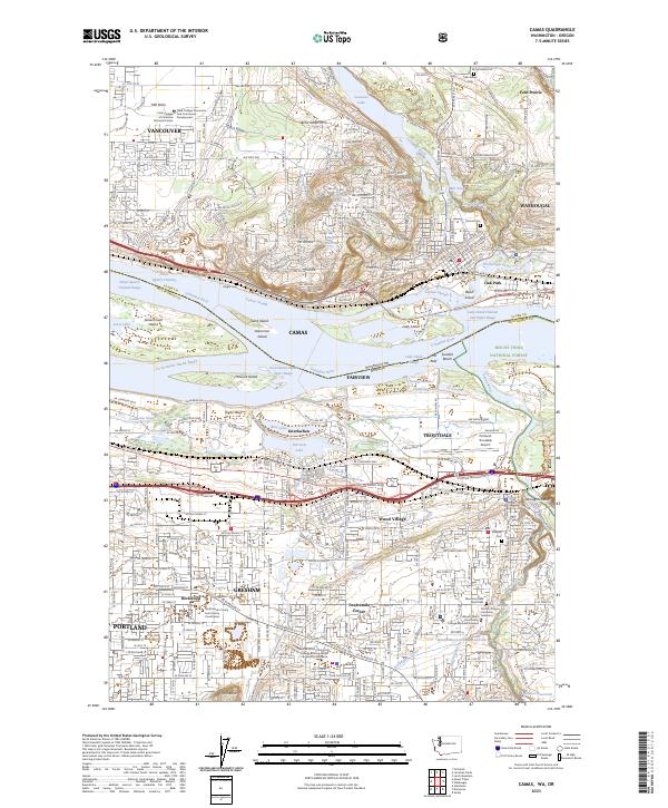
2023 Map of Camas
USGS Topo · Published 2023About this map
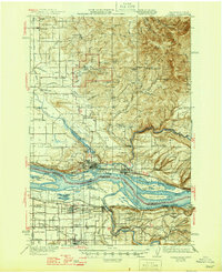
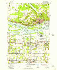
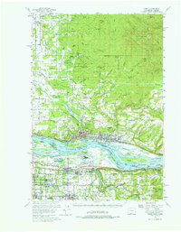
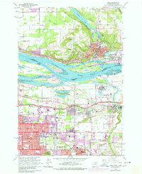
The Columbia River defines this Pacific Northwest landscape, marking the interstate boundary between Washington and Oregon. At the heart of the map, Camas and Washougal sit on the northern bank, where industrial sites like the Mill Pond and Camas Slough reflect a history tied to the water. To the south, the landscape shifts toward the growing outskirts of Portland and Gresham, with major transportation corridors like NE Sandy Blvd and the W Historic Columbia River Hwy tracing the southern river plain. Large river features including Government Island and Lady Island dominate the waterway, while the heights of Prune Hill and Tegart Bluff provide topographical contrast to the low-lying Columbia Slough. Local heritage is preserved in several burial grounds, such as Knight Cem and Fern Prairie Cem, and institutional landmarks like Clark College at Columbia Technical Center.
Find a feature on this map
74 named features on this map. Tap any name to fly to it.
Don’t see what you’re looking for? This feature index may not catch every label — zoom into the map to look around manually.
Map Details
Editions of this 2023 Camas Map
This is the sole edition of this map. No revisions or reprints were ever made.
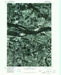
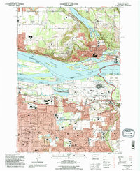
Historical Maps of Vancouver Through Time
8 maps found