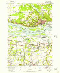
1954 Map of Camas
USGS Topo · Published 1957About this map
Industrial and aviation hubs define the mid-century landscape along the border of Washington and Oregon, centered on the Columbia River. The Washington side is dominated by Camas, where the riverbank is lined with infrastructure like the Spokane Portland and Seattle railroad. Across the water in Oregon, the Aluminum Plant and Troutdale Airport reflect the post-war industrial expansion. The map records several educational transitions, noting Grass Valley Sch (Aban'd), Woodburn Sch (Aban'd), and Forest Home School (Aban'd) as abandoned sites.
Find a feature on this map
56 named features on this map. Tap any name to fly to it.
Don’t see what you’re looking for? This feature index may not catch every label — zoom into the map to look around manually.
Map Details
Editions of this 1954 Camas Map
This is the sole edition of this map. No revisions or reprints were ever made.
Other maps of this area

1897 · Portland
USGS Topo · 1:62,500

1905 · Portland
USGS Topo · 1:62,500

1911 · Boring
USGS Topo · 1:48,000

1914 · Boring
USGS Topo · 1:62,500

1914 · Oregon City
USGS Topo · 1:62,500

1916 · Estacada
USGS Topo · 1:125,000

1918 · Troutdale
USGS Topo · 1:62,500

1934 · Troutdale
USGS Topo · 1:48,000

1939 · Oregon City
USGS Topo · 1:62,500

1940 · Boring
USGS Topo · 1:62,500