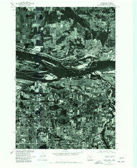
1975 Map of Camas
USGS Topo · Published 1977About this map
The Columbia River serves as the central artery in this 1975 orthophotograph, marking the boundary between Washington and Oregon. This specialized survey, produced in cooperation with the U. S. Corps of Engineers, provides a photographic record of mid-1970s land use. On the northern bank, Camas sits at a bend in the river, showing the industrial and residential footprint of the era. South of the water, the transition from agricultural fields to the suburban expansion of Rockwood and the edge of Gresham is clearly visible. The imagery captures the specific geometry of the mid-century landscape, from the braided channels and islands of the river to the evolving grid of modern residential developments and industrial sites that were reshaping the region during this period of growth.
Find a feature on this map
4 named features on this map. Tap any name to fly to it.
Don’t see what you’re looking for? This feature index may not catch every label — zoom into the map to look around manually.
Map Details
Editions of this 1975 Camas Map
This is the sole edition of this map. No revisions or reprints were ever made.
Other maps of this area

1897 · Portland
USGS Topo · 1:62,500

1905 · Portland
USGS Topo · 1:62,500

1911 · Boring
USGS Topo · 1:48,000

1914 · Boring
USGS Topo · 1:62,500

1914 · Oregon City
USGS Topo · 1:62,500

1916 · Estacada
USGS Topo · 1:125,000

1918 · Troutdale
USGS Topo · 1:62,500

1934 · Troutdale
USGS Topo · 1:48,000

1939 · Oregon City
USGS Topo · 1:62,500

1940 · Boring
USGS Topo · 1:62,500