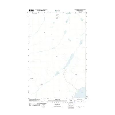
2011 Map of Camas Ridge East
USGS Topo · Published 2011About this map
Paul Bunyans Cabin sits high in the northern reaches of this Flathead County landscape, a wilderness area defined by steep drainages and glacial water bodies. The terrain is marked by significant elevations including Wolf Gun Mountain and Longfellow Peak, while the southeastern corner of the map captures the northern edge of Lake McDonald. A series of interconnected waterways, such as Camas Creek, flow through the valley between Dutch Ridge and Camas Ridge. The map details a high-altitude ecosystem where features like Rogers Meadow and Trout Lake are situated beneath the shadows of Rogers Peak and Stanton Mountain. This 2011 survey provides a clear view of the complex hydrology of the region, tracing the paths of Anaconda Creek and Dutch Creek as they navigate the rocky interior.
Find a feature on this map
19 named features on this map. Tap any name to fly to it.
Don’t see what you’re looking for? This feature index may not catch every label — zoom into the map to look around manually.
Map Details
Editions of this 2011 Camas Ridge East Map
This is the sole edition of this map. No revisions or reprints were ever made.
Other maps of this area

1904 · Chief Mountain
USGS Topo · 1:125,000

1906 · Kintla Lakes
USGS Topo · 1:125,000

1938 · Chief Mountain
USGS Topo · 1:125,000

1938 · Kintla Lakes
USGS Topo · 1:125,000

1957 · Kalispell
USGS Topo · 1:250,000

1960 · Kalispell
USGS Topo · 1:250,000

1960 · Cut Bank
USGS Topo · 1:250,000

1961 · Kalispell
USGS Topo · 1:250,000

1963 · Cut Bank
USGS Topo · 1:250,000

1964 · Cut Bank
USGS Topo · 1:250,000