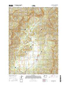
2017 Map of Camas Valley
USGS Topo · Published 2017About this map
Camas Valley sits at the heart of this landscape, where the Middle Fork Coquille River winds through a valley floor defined by a network of small reservoirs and family-named landmarks. The area's settlement history is remarkably well-preserved in the abundance of local cemeteries, including Thrush Cem, Noah Cem, and Martindale Cem, which are scattered near the river and its many tributaries. This 2017 survey illustrates the complex geography of the Douglas and Coos county line, dominated by significant relief features like Camas Mtn and Brewster Canyon. The map reveals a land shaped by both water and timber, with numerous logging roads and spurs like Suicide Creek Rd and Camas Mountain Sp providing access to the higher elevations and canyons. Smaller settlements like Little Muley and reservoirs such as Combs Reservoir and Thrush Reservoir further detail the rural infrastructure of this timber-rich region of Southern Oregon.
Find a feature on this map
91 named features on this map. Tap any name to fly to it.
Don’t see what you’re looking for? This feature index may not catch every label — zoom into the map to look around manually.
Map Details
Editions of this 2017 Camas Valley Map
This is the sole edition of this map. No revisions or reprints were ever made.
Other maps of this area

1928 · Sitkum
USGS Topo · 1:125,000

1946 · Dutchman Butte
USGS Topo · 1:62,500

1948 · Dutchman Butte
USGS Topo · 1:62,500

1954 · Bone Mountain
USGS Topo · 1:62,500

1955 · Camas Valley
USGS Topo · 1:62,500

1955 · Sitkum
USGS Topo · 1:62,500

1955 · Medford
USGS Topo · 1:250,000

1957 · Medford
USGS Topo · 1:250,000

1958 · Medford
USGS Topo · 1:250,000

1958 · Roseburg
USGS Topo · 1:250,000