
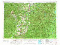
1958 Map of Roseburg
USGS Topo · Published 1960About this map
Roseburg serves as the central hub of this 1958 survey, situated where the North Umpqua River and South Umpqua River converge. The landscape is defined by the massive crests of the Cascade Range to the east and the Coast Range to the west, with the Calapooya Mountains bridging the two. Transportation follows the natural valley corridors, marked by the prominent path of the Southern Pacific railroad and Highway 99 connecting timber and agricultural towns like Cottage Grove, Sutherlin, and Drain.
Find a feature on this map
50 named features on this map. Tap any name to fly to it.
Don’t see what you’re looking for? This feature index may not catch every label — zoom into the map to look around manually.
Map Details
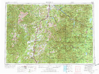
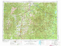
Editions of this 1958 Roseburg Map
4 editions found
Other maps of this area

1889 · Klamath
USGS Topo · 1:250,000

1891 · Ashland
USGS Topo · 1:250,000

1893 · Ashland
USGS Topo · 1:250,000

1894 · Klamath
USGS Topo · 1:250,000

1896 · Coos Bay
USGS Topo · 1:125,000

1897 · Roseburg
USGS Topo · 1:125,000

1897 · Ashland
USGS Topo · 1:250,000

1898 · Coos Bay
USGS Topo · 1:125,000

1899 · Port Orford
USGS Topo · 1:125,000

1900 · Roseburg
USGS Topo · 1:125,000