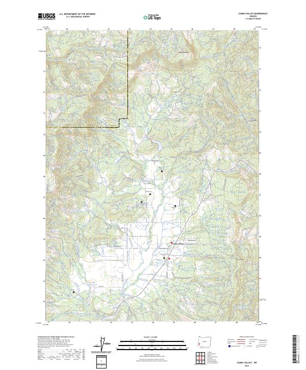
2024 Map of Camas Valley
USGS Topo · Published 2024About this map
Camas Valley occupies a fertile basin where the Middle Fork Coquille River meets several vital tributaries, including Noah Creek and Jim Belieu Creek. This Douglas County landscape is defined by the convergence of water and terrain, with the East Fork Coquille River carving through the northern heights near Bennett Rock. The distribution of family-named landmarks and multiple small burial grounds, such as Martindale Cem and Patterson Cem, suggests a long-standing rural community structure tied to the valley floor. Water management is a visible priority here, evidenced by the presence of Kannah Reservoir, Thrush Reservoir, and Denn Reservoir. The surrounding elevations, including Camas Mtn and Lower Burnt Mtn, are crisscrossed by a network of resource roads like Upper Camas Rd and Suicide Creek Rd, illustrating the intersection of the natural drainage systems and upland access routes used by generations in this part of Oregon.
Find a feature on this map
92 named features on this map. Tap any name to fly to it.
Don’t see what you’re looking for? This feature index may not catch every label — zoom into the map to look around manually.
Map Details
Editions of this 2024 Camas Valley Map
This is the sole edition of this map. No revisions or reprints were ever made.
Other maps of this area

1928 · Sitkum
USGS Topo · 1:125,000

1946 · Dutchman Butte
USGS Topo · 1:62,500

1948 · Dutchman Butte
USGS Topo · 1:62,500

1954 · Bone Mountain
USGS Topo · 1:62,500

1955 · Camas Valley
USGS Topo · 1:62,500

1955 · Sitkum
USGS Topo · 1:62,500

1955 · Medford
USGS Topo · 1:250,000

1957 · Medford
USGS Topo · 1:250,000

1958 · Medford
USGS Topo · 1:250,000

1958 · Roseburg
USGS Topo · 1:250,000