1917 Map of Cambon
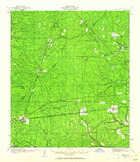
USGS Topo · Published 1962About this map
Baldwin serves as a central junction where the Seaboard Air Line and Atlantic Coast Line railroads converge, marking a significant transportation hub in western Duval County during the early twentieth century. This 1917 survey reveals a landscape of dense pine lands and wet prairies, including the expansive Brandy Branch Swamp and the headwaters of the Trout River. The map meticulously records the era's social infrastructure, documenting localized rural centers like Bryceville, Whitehouse, and the eponymous Cambon. Small-scale agrarian life is evidenced by a network of scattered country schools, such as the Higginbotham School and St Marys School, alongside community pillars like Bethel Church. The inclusion of the Lumber RR and Heber Tram Road highlights the importance of the regional timber industry, showing how industrial spurs reached deep into the cypress and pine flats to extract resources for the growing Florida markets.
Find a feature on this map
51 named features on this map. Tap any name to fly to it.
Don’t see what you’re looking for? This feature index may not catch every label — zoom into the map to look around manually.
Map Details
Editions of this 1917 Cambon Map
2 editions found
Other maps of this area

1917 · Orange Park
USGS Topo · 1:62,500

1917 · Cambon
USGS Topo · 1:62,500

1917 · Macclenny
USGS Topo · 1:62,500

1917 · Hilliard
USGS Topo · 1:62,500

1918 · St Marys
USGS Topo · 1:62,500

1918 · Middleburg
USGS Topo · 1:62,500

1918 · Moniac
USGS Topo · 1:62,500

1918 · Lawtey
USGS Topo · 1:62,500

1918 · Cambon
USGS Topo · 1:62,500

1918 · Jacksonville
USGS Topo · 1:62,500