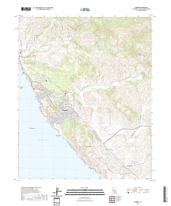
2021 Map of Cambria
USGS Topo · Published 2021About this map
Cambria and the small agricultural community of Harmony anchor this coastal survey, where the Santa Lucia Range meets the Pacific. The landscape is defined by its dramatic marine terraces and numerous creek drainages, including San Simeon Cr and Santa Rosa Cr, which flow toward notable landmarks like Moonstone Beach and Abalone Cove. The map details the residential expansion of the area through numerous named streets such as Cambria Pines Rd and Sunbury Ave.
Find a feature on this map
137 named features on this map. Tap any name to fly to it.
Don’t see what you’re looking for? This feature index may not catch every label — zoom into the map to look around manually.
Map Details
Editions of this 2021 Cambria Map
This is the sole edition of this map. No revisions or reprints were ever made.
Other maps of this area

1897 · Cayucos
USGS Topo · 1:62,500

1900 · San Luis
USGS Topo · 1:125,000

1919 · Adelaida
USGS Topo · 1:62,500

1919 · San Simeon
USGS Topo · 1:62,500

1932 · Adelaida
USGS Topo · 1:62,500

1937 · Cayucos
USGS Topo · 1:62,500

1937 · San Simeon
USGS Topo · 1:62,500

1942 · Adelaida
USGS Topo · 1:62,500

1943 · Cayucos
USGS Topo · 1:62,500

1947 · San Luis Obispo
USGS Topo · 1:250,000