2013 Map of Cambridge
USGS Topo · Published 2013About this map
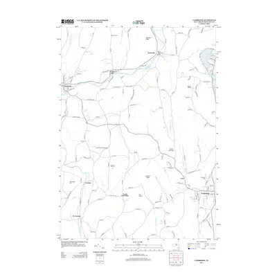
The Batten Kill river valley defines the northern reaches of this Washington County landscape, winding past the historic settlements of Greenwich, Center Falls, and Battenville. This 2013 survey illustrates the enduring agricultural character of the region, where family-named operations like Happy Hill Farm and Skiff Farm persist alongside specialized sites such as the Sunrise Mountain Buffalo Ranch. To the south and east, the topography rises toward Chestnut Ridge and Mount Colfax, overlooking a cluster of glacial lakes including Hedges Lake, Schoolhouse Lake, and Lake Lauderdale. The map provides significant detail for local historians, documenting the spatial relationship between the village of Cambridge and the adjacent hamlet of Coila, as well as the location of Woodland Cem and the Batten - Dugan Road Bridge.
Find a feature on this map
145 named features on this map. Tap any name to fly to it.
Don’t see what you’re looking for? This feature index may not catch every label — zoom into the map to look around manually.
Map Details
Editions of this 2013 Cambridge Map
This is the sole edition of this map. No revisions or reprints were ever made.
Other maps of this area

1893 · Cohoes
USGS Topo · 1:62,500

1895 · Cohoes
USGS Topo · 1:62,500

1895 · Cambridge
USGS Topo · 1:62,500

1897 · Hoosick
USGS Topo · 1:62,500

1898 · Cambridge
USGS Topo · 1:62,500

1898 · Cohoes
USGS Topo · 1:62,500

1900 · Taconic
USGS Topo · 1:125,000

1900 · Schuylerville
USGS Topo · 1:62,500

1901 · Cambridge
USGS Topo · 1:62,500

1903 · Mettawee
USGS Topo · 1:125,000