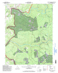
1995 Map of Camden on Gauley
USGS Topo · Published 1998About this map
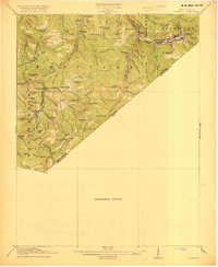
Camden on Gauley and Gauley Mills anchor the northwestern corner of this West Virginia landscape, where the Gauley River carves a deep valley through the high ridges of the Monongahela National Forest. The map documents a rugged timber and mining geography, evidenced by industrial sites like the Strip Mine Tipple near Holcomb and various rail sidings such as Harris Siding. Narrow valleys and creeks, including Strouds Creek and the Cherry River, dictated the placement of small communities and isolated homesteads.
Find a feature on this map
63 named features on this map. Tap any name to fly to it.
Don’t see what you’re looking for? This feature index may not catch every label — zoom into the map to look around manually.
Map Details
Editions of this 1995 Camden on Gauley Map
This is the sole edition of this map. No revisions or reprints were ever made.
Other maps of this area

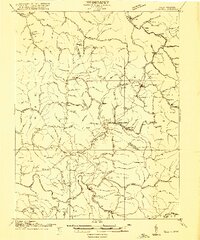
1889 · Nicholas
USGS Topo · 1:125,000

1891 · Nicholas
USGS Topo · 1:125,000

1891 · Huntersville
USGS Topo · 1:125,000

1894 · Huntersville
USGS Topo · 1:125,000

1901 · Nicholas
USGS Topo · 1:125,000

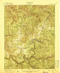
1915 · Webster Springs
USGS Topo · 1:48,000
1915 · Cowen
USGS Topo · 1:48,000
1917 · Cowen
USGS Topo · 1:62,500
1918 · Webster Springs
USGS Topo · 1:62,500
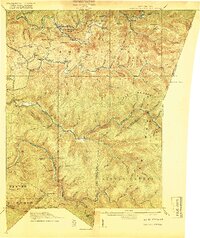
1918 · Richwood
USGS Topo · 1:62,500