
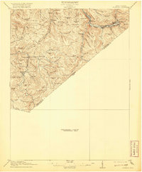
1918 Map of Richwood
USGS Topo · Published 1918About this map
Richwood stands as the industrial hub of this Nicholas County landscape, situated where the Cherry River meets the timber-heavy slopes of Big Mountain. The map illustrates a region deeply connected to the timber and rail industries, evidenced by the Cherry River Boom and Lumber Co RR and the Baltimore and Ohio RR winding through the river valleys. A dense network of community infrastructure is visible, with numerous rural educational sites including Mayflower School, Thorny Knob School, and White Buck School serving the scattered settlements.
Find a feature on this map
80 named features on this map. Tap any name to fly to it.
Don’t see what you’re looking for? This feature index may not catch every label — zoom into the map to look around manually.
Map Details
Editions of this 1918 Richwood Map
2 editions found
Other maps of this area

1887 · Hinton
USGS Topo · 1:125,000

1887 · Lewisburg
USGS Topo · 1:125,000

1889 · Nicholas
USGS Topo · 1:125,000

1891 · Lewisburg
USGS Topo · 1:125,000

1891 · Nicholas
USGS Topo · 1:125,000

1891 · Huntersville
USGS Topo · 1:125,000

1892 · Hinton
USGS Topo · 1:125,000

1894 · Huntersville
USGS Topo · 1:125,000

1901 · Nicholas
USGS Topo · 1:125,000

1912 · Meadow Creek
USGS Topo · 1:48,000