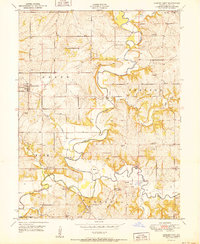
1951 Map of Camden Point
USGS Topo · Published 1951About this map
Camden Point and the winding course of the Platte River define this mid-century look at rural Missouri. The landscape is deeply tied to the river's meandering path and its fork with the Little Platte River, where a complex network of small rural schools and family-named cemeteries reflects a long-established farming community. Settlements like Ridgeley and Edgerton Junction are connected by a system of rural roads and distinctive crossings, including a Covered Bridge and the Skinner Bridge.
Find a feature on this map
43 named features on this map. Tap any name to fly to it.
Don’t see what you’re looking for? This feature index may not catch every label — zoom into the map to look around manually.
Map Details
Editions of this 1951 Camden Point Map
2 editions found
Other maps of this area

1890 · Kansas City
USGS Topo · 1:125,000

1894 · Kansas City
USGS Topo · 1:125,000

1910 · Leavenworth
USGS Topo · 1:62,500

1914 · Smithville
USGS Topo · 1:62,500

1925 · Gower
USGS Topo · 1:62,500

1927 · Dearborn
USGS Topo · 1:62,500
1948 · Nashua
USGS Topo · 1:24,000

1948 · Leavenworth
USGS Topo · 1:62,500

1950 · Kansas City
USGS Topo · 1:250,000
1950 · Nashua
USGS Topo · 1:24,000