Loading...
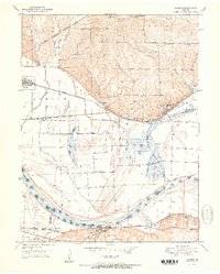
Loading map...1950 Map of Camden
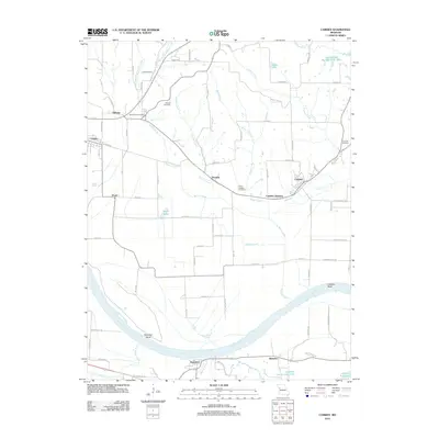
USGS Topo · Published 1979About this map
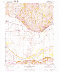
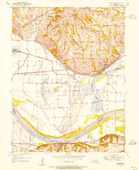
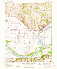
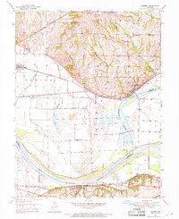
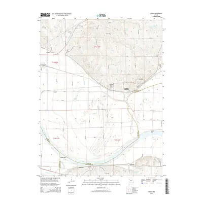
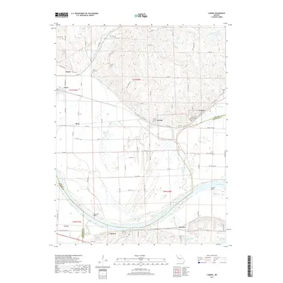
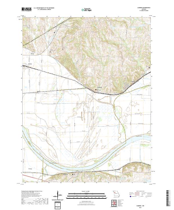
The Missouri River corridor in Ray and Lafayette Counties defines this mid-century landscape, where a dense network of railroads and protective levees supports a series of riverbank settlements. Significant rail infrastructure, including the Wabash, Pacific, and Atchison Topeka and Santa Fe, bisects the floodplain, connecting towns like Camden and Napoleon. Evidence of the local coal industry is visible near the river bluffs, marked by an Inactive Mine and a Mine Dump east of Camden.
Find a feature on this map
39 named features on this map. Tap any name to fly to it.
Don’t see what you’re looking for? This feature index may not catch every label — zoom into the map to look around manually.
Map Details
Date Portrayed1950
Date Published1979
PublisherU.S. Geological Survey
Map TypeTopographic
Scale1:24,000
Physical Dimensions22 x 26.9 inches
Editions of this 1950 Camden Map
4 editions found
Historical Maps of Orrick Through Time
6 maps found
Featured Locations
Source Details
SourceU.S. Geological Survey
CopyrightPublic Domain