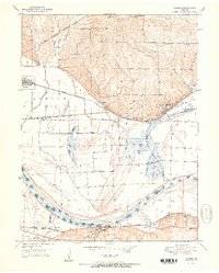
1951 Map of Camden
USGS Topo · Published 1951About this map
The Missouri River meanders through this landscape, flanked by an extensive network of levees and flood gates that protect the surrounding bottomlands and oxbows like Big Lake and Ralph Lake. To the north, the terrain transitions into the rolling hills of Richmond and Orrick, where the rail lines of the Wabash and the Atchison Topeka and Santa Fe parallel the river's path, serving industrial outposts like Fleming and the coal-producing area around Camden.
Find a feature on this map
48 named features on this map. Tap any name to fly to it.
Don’t see what you’re looking for? This feature index may not catch every label — zoom into the map to look around manually.
Map Details
Editions of this 1951 Camden Map
2 editions found
Other maps of this area

1889 · Lexington
USGS Topo · 1:125,000

1894 · Independence
USGS Topo · 1:125,000

1934 · Oak Grove
USGS Topo · 1:24,000

1935 · Buckner
USGS Topo · 1:24,000

1949 · Lexington West
USGS Topo · 1:24,000

1949 · Odessa North
USGS Topo · 1:24,000

1950 · Kansas City
USGS Topo · 1:250,000

1950 · Odessa North
USGS Topo · 1:24,000
1950 · Camden
USGS Topo · 1:24,000
1950 · Bates City
USGS Topo · 1:24,000