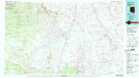
1982 Map of Cameron
USGS Topo · Published 1983About this map
Cameron serves as a central hub on the Navajo Indian Reservation in this 1982 survey, situated near the dramatic Little Colorado River Gorge. The landscape is defined by massive geographic features, including the Painted Desert and the rising Coconino Plateau. Notable archaeological and administrative sites are located in the southern portion of the map within the Wupatki National Monument, specifically Lomaki Ruin and Wukoki Ruin.
Find a feature on this map
106 named features on this map. Tap any name to fly to it.
Don’t see what you’re looking for? This feature index may not catch every label — zoom into the map to look around manually.
Map Details
Editions of this 1982 Cameron Map
This is the sole edition of this map. No revisions or reprints were ever made.
Other maps of this area

1883 · Marsh Pass
USGS Topo · 1:250,000

1883 · Tusayan
USGS Topo · 1:250,000

1886 · Tusayan
USGS Topo · 1:250,000

1886 · San Francisco Mtns
USGS Topo · 1:250,000

1886 · Chino
USGS Topo · 1:250,000

1886 · Echo Cliffs
USGS Topo · 1:250,000

1886 · Kaibab
USGS Topo · 1:250,000

1891 · San Francisco Mtns
USGS Topo · 1:250,000

1891 · Chino
USGS Topo · 1:250,000

1891 · Echo Cliffs
USGS Topo · 1:250,000