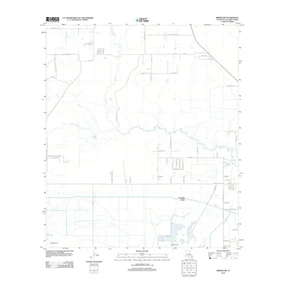
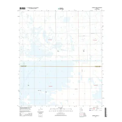
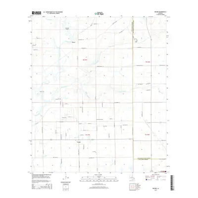
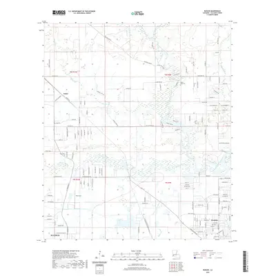
1949 Map of Cameron Farms
USGS Topo · Published 1949About this map
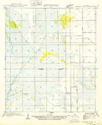
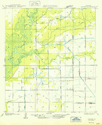
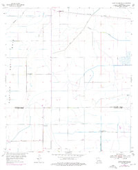
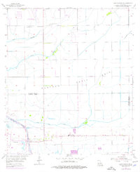
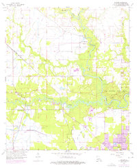
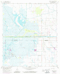
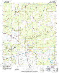
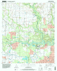
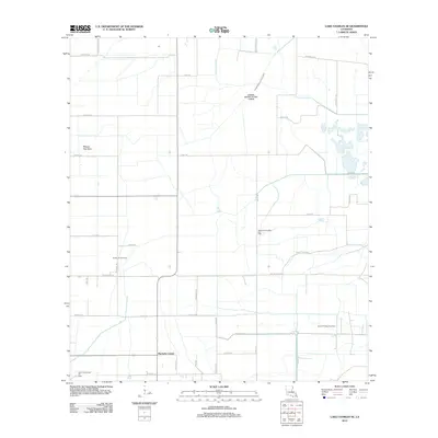
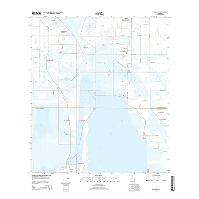
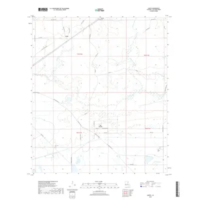
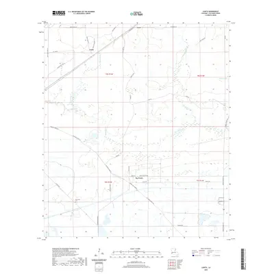
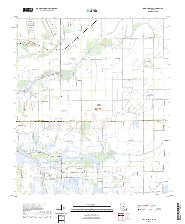
Calcasieu Parish and Cameron Parish meet in this landscape of managed waterways and low-lying coastal terrain. The settlement at Cameron Farms serves as a primary point of reference in a region defined by extensive drainage projects and industrial transit routes. The Intracoastal Waterway cuts a straight horizontal path across the center of the sheet, intersecting with natural features like Black Bayou and engineered arteries such as the Vinton Drainage Canal. The network of man-made channels, including the Henry Gray Canal and Bancroft Canal, illustrates early 20th-century efforts to reclaim and manage the wetlands for agricultural or industrial use. To the east, State Highway No 381 provides the primary overland connection, passing near Suttons Slip and the rural farmstead infrastructure.
Find a feature on this map
9 named features on this map. Tap any name to fly to it.
Don’t see what you’re looking for? This feature index may not catch every label — zoom into the map to look around manually.
Map Details
Editions of this 1949 Cameron Farms Map
This is the sole edition of this map. No revisions or reprints were ever made.
Historical Maps of Calcasieu Parish Through Time
82 maps found

1932 Lake Charles NE
Calcasieu Parish, LA

1932 Lake Charles NW
Calcasieu Parish, LA

1932 Lake Charles SE
Calcasieu Parish, LA

1932 Lake Charles SW
Calcasieu Parish, LA

1932 Moss Lake
Calcasieu Parish, LA

1935 Buhler
Calcasieu Parish, LA

1946 Moss Lake
Calcasieu Parish, LA

1947 Hecker
Calcasieu Parish, LA
1947 Lunita
Calcasieu Parish, LA

1947 Sulphur Mines
Calcasieu Parish, LA
1947 Toomey
Calcasieu Parish, LA

1947 West Lake
Calcasieu Parish, LA
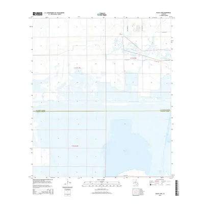
1949 Black Lake
Calcasieu Parish, LA
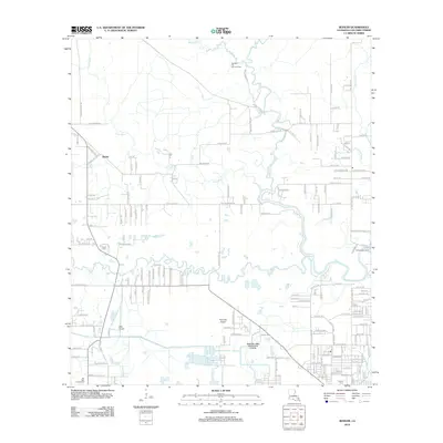
1949 Cameron Farms
Calcasieu Parish, LA
1950 Hecker
Calcasieu Parish, LA
1954 Toomey
Calcasieu Parish, LA
1954 West Lake
Calcasieu Parish, LA
1955 Black Lake
Calcasieu Parish, LA
1955 Lake Charles SE
Calcasieu Parish, LA
1955 Lake Charles SW
Calcasieu Parish, LA
1955 Moss Lake
Calcasieu Parish, LA
1956 Brimstone
Calcasieu Parish, LA
1956 Buhler
Calcasieu Parish, LA
1956 De Quincy
Calcasieu Parish, LA
1956 De Quincy
Calcasieu Parish, LA
1956 Hecker
Calcasieu Parish, LA
1960 Cameron Farms
Calcasieu Parish, LA
1982 Lunita
Calcasieu Parish, LA
1994 De Quincy
Calcasieu Parish, LA
1994 Hecker
Calcasieu Parish, LA
1994 Lunita
Calcasieu Parish, LA
1994 Moss Lake
Calcasieu Parish, LA
1998 Black Lake
Calcasieu Parish, LA
1998 Brimstone
Calcasieu Parish, LA
1998 Buhler
Calcasieu Parish, LA
1998 Lake Charles SE
Calcasieu Parish, LA
1998 Lake Charles SW
Calcasieu Parish, LA
2012 Black Lake
Calcasieu Parish, LA
2012 Brimstone
Calcasieu Parish, LA
2012 Buhler
Calcasieu Parish, LA
2012 Cameron Farms
Calcasieu Parish, LA
2012 Hecker
Calcasieu Parish, LA
2012 Lake Charles SE
Calcasieu Parish, LA
2012 Lake Charles SW
Calcasieu Parish, LA
2012 Lunita
Calcasieu Parish, LA
2012 Moss Lake
Calcasieu Parish, LA
2015 Black Lake
Calcasieu Parish, LA
2015 Brimstone
Calcasieu Parish, LA
2015 Buhler
Calcasieu Parish, LA
2015 Cameron Farms
Calcasieu Parish, LA
2015 Hecker
Calcasieu Parish, LA
2015 Lake Charles SE
Calcasieu Parish, LA
2015 Lake Charles SW
Calcasieu Parish, LA
2015 Lunita
Calcasieu Parish, LA
2015 Moss Lake
Calcasieu Parish, LA
2018 Black Lake
Calcasieu Parish, LA
2018 Brimstone
Calcasieu Parish, LA
2018 Buhler
Calcasieu Parish, LA
2018 Cameron Farms
Calcasieu Parish, LA
2018 Hecker
Calcasieu Parish, LA
2018 Lake Charles SE
Calcasieu Parish, LA
2018 Lake Charles SW
Calcasieu Parish, LA
2018 Lunita
Calcasieu Parish, LA
2018 Moss Lake
Calcasieu Parish, LA
2020 Black Lake
Calcasieu Parish, LA
2020 Brimstone
Calcasieu Parish, LA
2020 Buhler
Calcasieu Parish, LA
2020 Cameron Farms
Calcasieu Parish, LA

2020 Hecker
Calcasieu Parish, LA
2020 Lake Charles SE
Calcasieu Parish, LA
2020 Lake Charles SW
Calcasieu Parish, LA
2020 Lunita
Calcasieu Parish, LA
2020 Moss Lake
Calcasieu Parish, LA
2024 Black Lake
Calcasieu Parish, LA
2024 Brimstone
Calcasieu Parish, LA
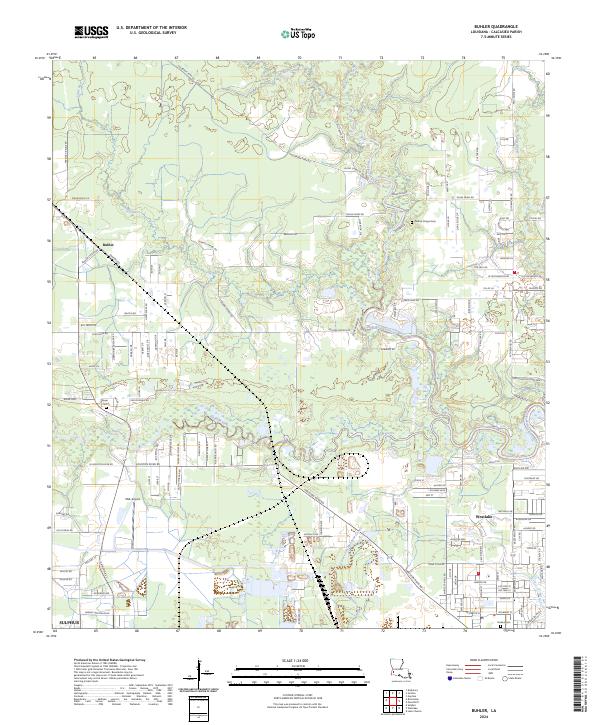
2024 Buhler
Calcasieu Parish, LA
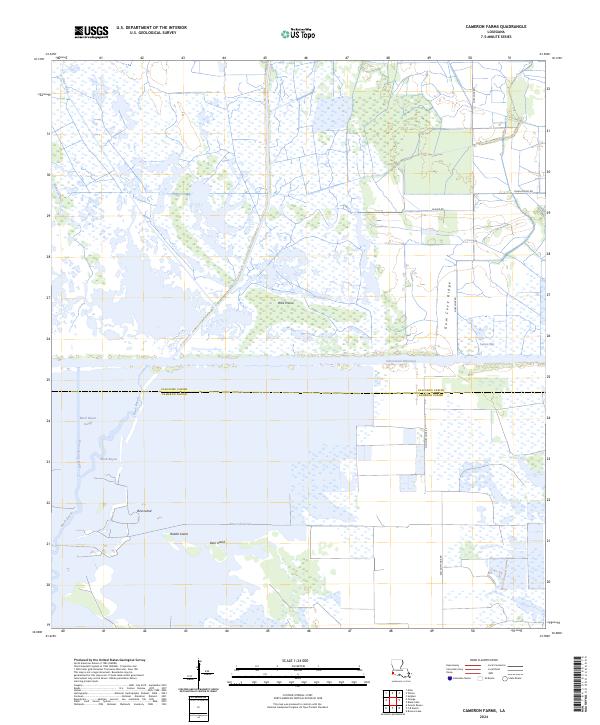
2024 Cameron Farms
Calcasieu Parish, LA
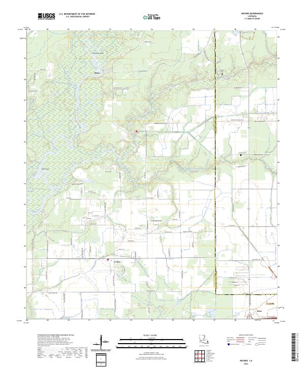
2024 Hecker
Calcasieu Parish, LA
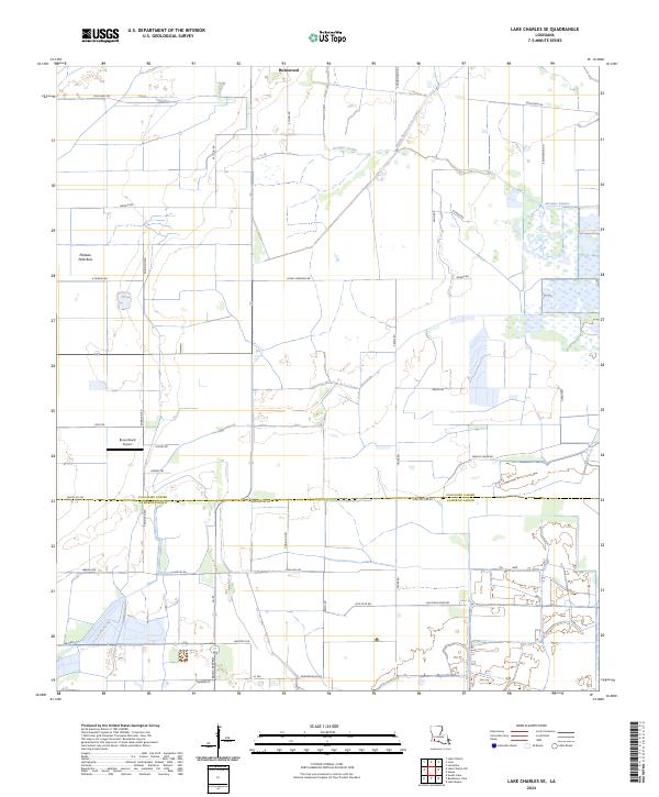
2024 Lake Charles SE
Calcasieu Parish, LA
2024 Lake Charles SW
Calcasieu Parish, LA
2024 Lunita
Calcasieu Parish, LA
2024 Moss Lake
Calcasieu Parish, LA