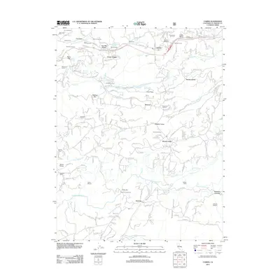
2012 Map of Camino
USGS Topo · Published 2012About this map
The agricultural heart of El Dorado County's foothills is meticulously detailed in this survey, emphasizing a landscape defined by orchards and vineyards. Concentrations of fruit-growing operations such as High Hill Ranch, Abels Apple Acres, and Goldbud Farms cluster along the northern ridges, reflecting the region's enduring identity as a premium apple and grape producing corridor. The settlement of Camino and nearby Camino Heights serve as central hubs, while smaller historical nodes like Newtown and Pleasant Valley anchor the southern portion of the sheet.
Find a feature on this map
212 named features on this map. Tap any name to fly to it.
Don’t see what you’re looking for? This feature index may not catch every label — zoom into the map to look around manually.
Map Details
Editions of this 2012 Camino Map
This is the sole edition of this map. No revisions or reprints were ever made.
Other maps of this area

1891 · Placerville
USGS Topo · 1:125,000

1892 · Placerville
USGS Topo · 1:125,000

1893 · Placerville
USGS Topo · 1:125,000

1947 · Sacramento
USGS Topo · 1:250,000

1948 · Sacramento
USGS Topo · 1:250,000

1949 · Georgetown
USGS Topo · 1:62,500

1949 · Placerville
USGS Topo · 1:62,500

1949 · Placerville
USGS Topo · 1:24,000
1949 · Fiddletown
USGS Topo · 1:24,000
1949 · Garden Valley
USGS Topo · 1:24,000