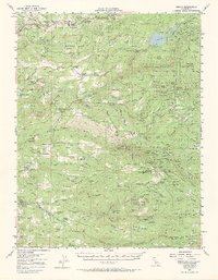
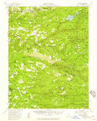
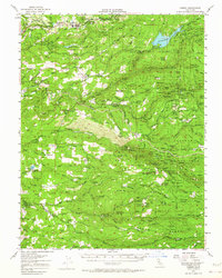
1952 Map of Camino
USGS Topo · Published 1971About this map
Camino and the surrounding Sierra Nevada foothills are captured in this mid-century record of El Dorado and Amador Counties. The landscape is defined by the deep canyons of the North Fork Cosumnes River and its sister forks, where small mountain settlements like Grizzly Flat and Omo Ranch served as hubs for local industry. The map reveals a high concentration of historic mining operations along Gold Note Ridge, including the Caldor Mine, Payne Mine, and the Independence Mine.
Find a feature on this map
130 named features on this map. Tap any name to fly to it.
Don’t see what you’re looking for? This feature index may not catch every label — zoom into the map to look around manually.
Map Details
Editions of this 1952 Camino Map
3 editions found
Other maps of this area

1889 · Jackson
USGS Topo · 1:125,000

1889 · Pyramid Peak
USGS Topo · 1:125,000

1891 · Big Trees
USGS Topo · 1:125,000

1891 · Placerville
USGS Topo · 1:125,000

1891 · Pyramid Peak
USGS Topo · 1:125,000

1892 · Jackson
USGS Topo · 1:125,000

1892 · Placerville
USGS Topo · 1:125,000

1893 · Placerville
USGS Topo · 1:125,000

1894 · Big Trees
USGS Topo · 1:125,000

1895 · Pyramid Peak
USGS Topo · 1:125,000