
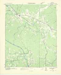
1935 Map of Camp Austin
USGS Topo · Published 1935About this map
Wartburg serves as a primary hub in the northern portion of this 1935 survey, situated just beneath the rise of Bird Mountain. The landscape is defined by the winding course of the Emory River and the complex terrain of the Cumberland Plateau, which includes The Love Plateau and Lone Mtn. Transportation is dominated by the Southern railroad line and a network of highways, including U S Highway No 27. The area's Depression-era development is evidenced by the presence of CCC Camp No 1463 near the river's bend. Rural community life is anchored by several small schoolhouses such as Piney Sch and Deermont Sch, along with Liberty Ch and Mossy Grove Ch, while resource extraction is noted by a Coal deposit near Camp Austin.
Find a feature on this map
41 named features on this map. Tap any name to fly to it.
Don’t see what you’re looking for? This feature index may not catch every label — zoom into the map to look around manually.
Map Details
Editions of this 1935 Camp Austin Map
2 editions found
Other maps of this area

1887 · Kingston
USGS Topo · 1:125,000

1891 · Kingston
USGS Topo · 1:125,000

1893 · Briceville
USGS Topo · 1:125,000

1893 · Kingston
USGS Topo · 1:125,000

1895 · Wartburg
USGS Topo · 1:125,000

1895 · Loudon
USGS Topo · 1:125,000

1895 · Briceville
USGS Topo · 1:125,000

1896 · Wartburg
USGS Topo · 1:125,000

1896 · Briceville
USGS Topo · 1:125,000

1935 · Gobey
USGS Topo · 1:24,000