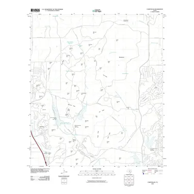
2010 Map of Camp Bullis
USGS Topo · Published 2010About this map
Cibolo Creek and Salado Creek define the complex drainage patterns of this northern San Antonio landscape, where military training grounds meet suburban expansion. The sheet is dominated by the ridges and named heights of the Edwards Plateau, including McCaskey Ridge, Aue Hill, and Harrison Hill. Significant water management features like the Soil Conservation Service Site 1 Reservoir and several earthen tanks, such as Cavalry Tank and German Tank, reveal the area's transition from traditional ranching to controlled flood management. The northern extent of the Dominion neighborhood and the Presence of Camp Bullis A Landing Strip highlight the dual identity of the region as both an elite residential area and a vital military installation. Researchers will find interest in localized history at Gerfers Cemetery and the sprawling Mission Burial Park near the Leon Creek headwaters.
Find a feature on this map
105 named features on this map. Tap any name to fly to it.
Don’t see what you’re looking for? This feature index may not catch every label — zoom into the map to look around manually.
Map Details
Editions of this 2010 Camp Bullis Map
This is the sole edition of this map. No revisions or reprints were ever made.
Other maps of this area

1920 · Smithsons Valley
USGS Topo · 1:62,500

1927 · Smithson Valley
USGS Topo · 1:62,500

1929 · Smithson Valley
USGS Topo · 1:62,500

1940 · Smithson Valley
USGS Topo · 1:62,500

1953 · Otis Ridge
USGS Topo · 1:24,000

1953 · Bulverde
USGS Topo · 1:24,000

1953 · Longhorn
USGS Topo · 1:24,000

1953 · Helotes
USGS Topo · 1:24,000

1953 · Castle Hills
USGS Topo · 1:24,000

1953 · Van Raub
USGS Topo · 1:24,000