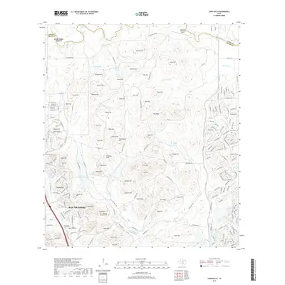
2019 Map of Camp Bullis
USGS Topo · Published 2019About this map
San Antonio and the expanding northern suburbs of Bexar County meet the high, rolling terrain of the Texas Hill Country in this modern survey. The landscape is defined by its military and aviation history, centered on the Camp Bullis ALS (Cals) Airport and a series of named ridges and summits including Mont Blanc, Butte Hill, and Caisson Hill. To the northwest, the residential growth of Fair Oaks Ranch and Dominion contrasts with the specialized facilities of the Mission North Burial Park.
Find a feature on this map
114 named features on this map. Tap any name to fly to it.
Don’t see what you’re looking for? This feature index may not catch every label — zoom into the map to look around manually.
Map Details
Editions of this 2019 Camp Bullis Map
This is the sole edition of this map. No revisions or reprints were ever made.
Other maps of this area

1920 · Smithsons Valley
USGS Topo · 1:62,500

1927 · Smithson Valley
USGS Topo · 1:62,500

1929 · Smithson Valley
USGS Topo · 1:62,500

1940 · Smithson Valley
USGS Topo · 1:62,500

1953 · Otis Ridge
USGS Topo · 1:24,000

1953 · Bulverde
USGS Topo · 1:24,000

1953 · Longhorn
USGS Topo · 1:24,000

1953 · Helotes
USGS Topo · 1:24,000

1953 · Castle Hills
USGS Topo · 1:24,000

1953 · Van Raub
USGS Topo · 1:24,000