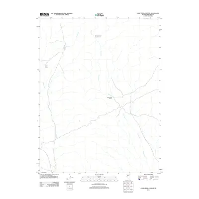
2011 Map of Camp Creek Canyon
USGS Topo · Published 2011About this map
Bench Creek Ranch stands as the primary human landmark in this part of Nevada's high desert, situated along the western edge of the quadrangle. The landscape is defined by its drainage systems, with Bench Creek flowing through the western corridor and Camp Creek carving through the center and east. These watercourses have created a complex network of topographical features, most notably the deep cuts of Camp Creek Canyon and Bench Creek Canyon. The northeast is dominated by the East Fork Camp Creek Canyon, illustrating the rugged erosional patterns of the Great Basin. This 2011 survey documents a sparse, high-altitude environment where modern dirt roads follow the ancient paths of least resistance through the canyon floors and across open benches.
Find a feature on this map
6 named features on this map. Tap any name to fly to it.
Don’t see what you’re looking for? This feature index may not catch every label — zoom into the map to look around manually.
Map Details
Editions of this 2011 Camp Creek Canyon Map
This is the sole edition of this map. No revisions or reprints were ever made.
Other maps of this area

1908 · Carson Sink
USGS Topo · 1:250,000

1910 · Carson Sink
USGS Topo · 1:250,000

1955 · Millett
USGS Topo · 1:250,000

1957 · Reno
USGS Topo · 1:250,000

1959 · Reno
USGS Topo · 1:250,000

1959 · Millett
USGS Topo · 1:250,000

1960 · Reno
USGS Topo · 1:250,000

1966 · Clan Alpine Ranch
USGS Topo · 1:62,500

1969 · Camp Creek Canyon
USGS Topo · 1:24,000

1969 · Cold Springs
USGS Topo · 1:24,000