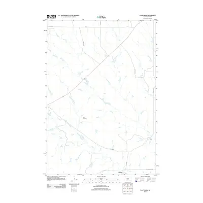
2012 Map of Camp Creek
USGS Topo · Published 2012About this map
Sulphur sits at the southern edge of this West River landscape, where the prairie is defined by a network of seasonal drainages and rural corridors. The map details a ranching and agricultural region centered around the confluence of watercourses like Sulphur Cr and Camp Cr. Notable for genealogical research is the Plum Draw Cem, located near the geographical feature of Plum Draw. This survey captures the sparse settlement pattern of northern Meade County, where life follows the paths of named roads such as Mud Butte Rd and Sulphur Cutoff Rd. The topography illustrates the subtle relief of the plains, punctuated by minor draws and the winding paths of Plum Cr and Lottie Cr.
Find a feature on this map
17 named features on this map. Tap any name to fly to it.
Don’t see what you’re looking for? This feature index may not catch every label — zoom into the map to look around manually.
Map Details
Editions of this 2012 Camp Creek Map
This is the sole edition of this map. No revisions or reprints were ever made.
Other maps of this area

1913 · Newell
USGS Topo · 1:125,000

1935 · Hoover
USGS Topo · 1:125,000

1953 · Rapid City
USGS Topo · 1:250,000

1954 · Lemmon
USGS Topo · 1:250,000

1957 · Lemmon
USGS Topo · 1:250,000

1957 · Rapid City
USGS Topo · 1:250,000

1973 · Frozen Man Creek
USGS Topo · 1:24,000

1977 · Table Top Butte
USGS Topo · 1:24,000
1977 · Owl Butte SE
USGS Topo · 1:24,000
1978 · Owl Butte NE
USGS Topo · 1:24,000