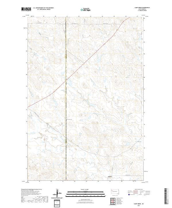
2021 Map of Camp Creek
USGS Topo · Published 2021About this map
The boundary line between Butte and Meade Counties bisects this high plains landscape, defining the administrative layout of this rural South Dakota region. The tiny settlement of Sulphur sits near the southern edge of the map, located at the junction of Co Hwy MC-23 and Co Hwy MC-28. The terrain is shaped by the winding drainage of Camp Creek and its tributary Lottie Creek, which cut across the eastern half of the quadrangle. For genealogists and local historians, the Plum Draw Cem provides a significant landmark near the county line. The transportation network is a mix of traditional county roads like Mud Butte Rd and historical remnants like Old 212, which follows a diagonal path across the northeastern section, reflecting the evolution of regional thoroughfares through this open territory.
Find a feature on this map
17 named features on this map. Tap any name to fly to it.
Don’t see what you’re looking for? This feature index may not catch every label — zoom into the map to look around manually.
Map Details
Editions of this 2021 Camp Creek Map
This is the sole edition of this map. No revisions or reprints were ever made.
Other maps of this area

1913 · Newell
USGS Topo · 1:125,000

1935 · Hoover
USGS Topo · 1:125,000

1953 · Rapid City
USGS Topo · 1:250,000

1954 · Lemmon
USGS Topo · 1:250,000

1957 · Lemmon
USGS Topo · 1:250,000

1957 · Rapid City
USGS Topo · 1:250,000

1973 · Frozen Man Creek
USGS Topo · 1:24,000

1977 · Table Top Butte
USGS Topo · 1:24,000
1977 · Owl Butte SE
USGS Topo · 1:24,000
1978 · Owl Butte NE
USGS Topo · 1:24,000