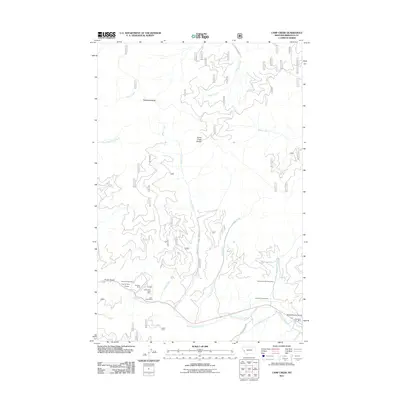
2011 Map of Camp Creek
USGS Topo · Published 2011About this map
Triantler sits at the base of the Grave Creek Range in this Missoula County landscape, where the mining industry has left a significant imprint on the terrain. The southern portion of the map is defined by the drainage of West Fork Lolo Creek, a corridor where various resource extraction operations were concentrated. Prospectors and historians can trace the locations of several named workings, including the Lawyers Combination Mine and the Lolo Creek Mine, which suggest a period of active mineral exploration along the gulches and creek beds.
Find a feature on this map
27 named features on this map. Tap any name to fly to it.
Don’t see what you’re looking for? This feature index may not catch every label — zoom into the map to look around manually.
Map Details
Editions of this 2011 Camp Creek Map
This is the sole edition of this map. No revisions or reprints were ever made.
Other maps of this area

1912 · Missoula
USGS Topo · 1:125,000

1956 · Hamilton
USGS Topo · 1:250,000

1959 · Hamilton
USGS Topo · 1:250,000

1960 · Hamilton
USGS Topo · 1:250,000

1963 · Primrose
USGS Topo · 1:24,000

1964 · Hamilton
USGS Topo · 1:250,000
1964 · Diamond Point
USGS Topo · 1:24,000

1964 · Garden Point
USGS Topo · 1:24,000

1964 · Dick Creek
USGS Topo · 1:24,000

1964 · West Fork Butte
USGS Topo · 1:24,000