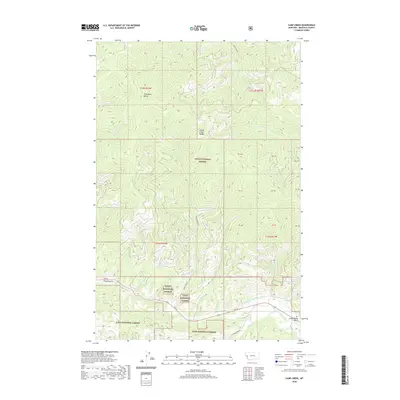
2020 Map of Camp Creek
USGS Topo · Published 2020About this map
Lolo National Forest dominates this mountain landscape in Missoula County, centered on the high elevations of the Grave Creek Range. The drainage patterns of the area are defined by several watercourses including Lolo Creek and the S Fork Lolo Cr, which flow through deep valleys shaped by landforms like Potato Gulch and Schoolhouse Gulch. Human activity in these timberlands is marked by a network of forest access routes such as Bear Creek Rd and Elk Meadows Rd, alongside historical infrastructure like the Williams Preston Hoyet Ditch. Notable peaks like Telephone Butte provide vantage points over the numerous tributaries, including O'Brien Cr and Woodman Cr, which carve through the dense terrain of the Bitterroot mountains.
Find a feature on this map
24 named features on this map. Tap any name to fly to it.
Don’t see what you’re looking for? This feature index may not catch every label — zoom into the map to look around manually.
Map Details
Editions of this 2020 Camp Creek Map
This is the sole edition of this map. No revisions or reprints were ever made.
Other maps of this area

1912 · Missoula
USGS Topo · 1:125,000

1956 · Hamilton
USGS Topo · 1:250,000

1959 · Hamilton
USGS Topo · 1:250,000

1960 · Hamilton
USGS Topo · 1:250,000

1963 · Primrose
USGS Topo · 1:24,000

1964 · Hamilton
USGS Topo · 1:250,000
1964 · Diamond Point
USGS Topo · 1:24,000

1964 · Garden Point
USGS Topo · 1:24,000

1964 · Dick Creek
USGS Topo · 1:24,000

1964 · West Fork Butte
USGS Topo · 1:24,000