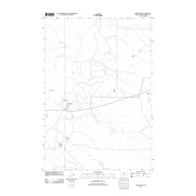
2012 Map of Camp Crook
USGS Topo · Published 2012About this map
The Little Missouri River meanders through this remote portion of Harding County, carving a path through a landscape defined by significant drainage features and ranching heritage. Local history is etched into the terrain through descriptively named landmarks such as Grandma Schang Draw, Hoag Coal Mine Draw, and Dead Man Hill, which reflect the early homesteading and resource extraction of the region. The presence of Mosely Ranch and the Catron Ranch Airstrip highlights the importance of large-scale landholdings and private aviation in this sparsely populated territory. Infrastructure in the early 21st century includes the Camp Crook Municipal Airport and a small grid of streets such as 3rd St and Park Ave. Water management for the arid environment is evidenced by the Cundy Reservoir and several named creeks including Antelope Cr, Ash Cr, and Waterhole Cr. The Fairview Cem remains a quiet landmark of the local community near the river’s edge.
Find a feature on this map
24 named features on this map. Tap any name to fly to it.
Don’t see what you’re looking for? This feature index may not catch every label — zoom into the map to look around manually.
Map Details
Editions of this 2012 Camp Crook Map
This is the sole edition of this map. No revisions or reprints were ever made.
Other maps of this area

1935 · Harding
USGS Topo · 1:125,000

1935 · Buffalo
USGS Topo · 1:125,000

1954 · Lemmon
USGS Topo · 1:250,000

1954 · Ekalaka
USGS Topo · 1:250,000

1956 · Ekalaka
USGS Topo · 1:250,000

1957 · Lemmon
USGS Topo · 1:250,000

1958 · Ekalaka
USGS Topo · 1:250,000

1965 · Ekalaka
USGS Topo · 1:250,000

1973 · Gallup Creek
USGS Topo · 1:24,000

1974 · Caroline Butte
USGS Topo · 1:24,000