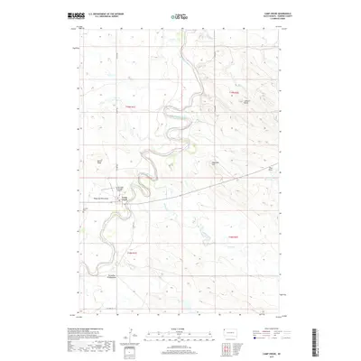
2017 Map of Camp Crook
USGS Topo · Published 2017About this map
Camp Crook serves as the focal point of this western South Dakota landscape, positioned along the meandering banks of the Little Missouri River. The area is defined by a series of dramatic geographic features with names that hint at the local history and folklore of Harding County, such as Dead Man Hill, Battle Ridge, and Grandma Schang Draw. The river's winding course creates a complex riparian corridor through the dry plains, supported by several intermittent tributaries including Valley Creek and K Bar Cr.
Find a feature on this map
25 named features on this map. Tap any name to fly to it.
Don’t see what you’re looking for? This feature index may not catch every label — zoom into the map to look around manually.
Map Details
Editions of this 2017 Camp Crook Map
This is the sole edition of this map. No revisions or reprints were ever made.
Other maps of this area

1935 · Harding
USGS Topo · 1:125,000

1935 · Buffalo
USGS Topo · 1:125,000

1954 · Lemmon
USGS Topo · 1:250,000

1954 · Ekalaka
USGS Topo · 1:250,000

1956 · Ekalaka
USGS Topo · 1:250,000

1957 · Lemmon
USGS Topo · 1:250,000

1958 · Ekalaka
USGS Topo · 1:250,000

1965 · Ekalaka
USGS Topo · 1:250,000

1973 · Gallup Creek
USGS Topo · 1:24,000

1974 · Caroline Butte
USGS Topo · 1:24,000