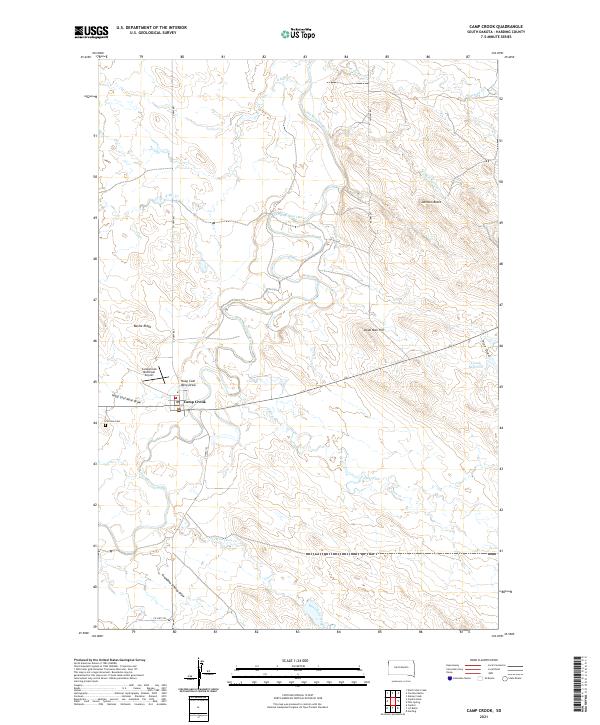
2021 Map of Camp Crook
USGS Topo · Published 2021About this map
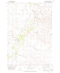
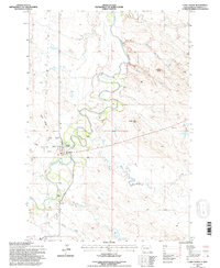
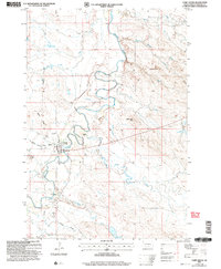
Camp Crook anchors this corner of the High Plains, situated along a prominent bend of the Little Missouri River. The topography is defined by significant drainage systems and high points like Johnson Butte and Dead Man Hill, which overlook a network of seasonal watercourses. Local nomenclature preserves the region’s heritage through labels like Grandma Schang Draw, Hoag Coal Mine Draw, and Battle Ridge. While the Camp Crook Municipal Airport serves modern transit, the presence of Fairview Cem west of town provides a fixed point for genealogical research. The landscape transition from river bottom to high draws is evident where Pine Draw meets the Cundy Reservoir, reflecting the rural ranching and resource-based economy of northwestern South Dakota.
Find a feature on this map
25 named features on this map. Tap any name to fly to it.
Don’t see what you’re looking for? This feature index may not catch every label — zoom into the map to look around manually.
Map Details
Editions of this 2021 Camp Crook Map
This is the sole edition of this map. No revisions or reprints were ever made.
Historical Maps of Camp Crook Through Time
5 maps found