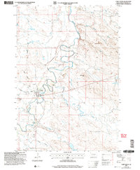
2005 Map of Camp Crook
USGS Topo · Published 2007About this map
Camp Crook serves as the focal point for this survey of Harding County, situated along the meandering banks of the Little Missouri River. The settlement pattern reflects a classic Western livestock economy, with operations such as Catron Ranch and K Bar marking the transition from the river valley to the higher breaks. To the west, Battle Ridge and the Hoag Coal Mine Draw indicate the geological and industrial character of the landscape, while the presence of the Rodeo Ground and Municipal Airport highlights the town's role as a regional hub.
Find a feature on this map
20 named features on this map. Tap any name to fly to it.
Don’t see what you’re looking for? This feature index may not catch every label — zoom into the map to look around manually.
Map Details
Editions of this 2005 Camp Crook Map
This is the sole edition of this map. No revisions or reprints were ever made.
Other maps of this area

1935 · Harding
USGS Topo · 1:125,000

1935 · Buffalo
USGS Topo · 1:125,000

1954 · Lemmon
USGS Topo · 1:250,000

1954 · Ekalaka
USGS Topo · 1:250,000

1956 · Ekalaka
USGS Topo · 1:250,000

1957 · Lemmon
USGS Topo · 1:250,000

1958 · Ekalaka
USGS Topo · 1:250,000

1965 · Ekalaka
USGS Topo · 1:250,000

1973 · Gallup Creek
USGS Topo · 1:24,000

1974 · Caroline Butte
USGS Topo · 1:24,000